#09 Hurricane - Indian Ocean Strategy - Plotter - Vertical Time
5 avril 2026 · 40 min · 3K vues · Océano Índico
Sailor tracks hurricane on plotter during night passage.
Ce que couvre cette vidéo
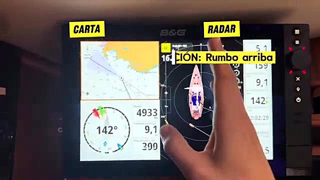
The crew of a seven-person sailing vessel navigating the Indian Ocean toward Chile utilizes B&G chartplotters and PredictWind software to manage weather strategy and monitor cyclonic activity.Watch The team maintains a 45-degree latitude route to avoid tropical cyclone zones, planning to drop further south only after passing the Kerguelen Islands.14:25 Onboard, the crew operates on a rotating watch system—three watch captains working four-hour shifts and four crew members working three-hour shifts—while coordinating meal times based on local time zones adjusted every 15 degrees of longitude.1:46 The B&G system displays radar overlays and wind history, which the crew uses to identify wind shifts during squalls and monitor current-induced speed variations.14:24 While the crew monitors iceberg data, they avoid high-latitude navigation below 55 degrees due to limited daylight hours and safety risks.23:40 Strong ocean currents frequently cause significant discrepancies between heading and course over ground, sometimes requiring substantial rudder adjustments.29:14
Plus de vidéos de Allende los Mares · Vuelta Vertical

De Allende los Mares · Vuelta Vertical — voir le bateau, l'équipage et chaque vidéo analysée de la chaîne.
The Sailing Directory Newsletter
Un e-mail avec les meilleures trouvailles de la flotte — les moments, les bateaux et les histoires qui valent la peine d'être regardés. Entrez votre adresse pour recevoir votre propre exemplaire.